Corny Point Lighthouse
Built to protect fully laden, southbound windjammers that were endangered by sou-westers which could bring them in on the Web Rock or onto the reefs and shoals of Berry Bay and Daly Head.
History
Because of the nature of the Yorke Peninsula jutting into the sea, and its isolation, most contact with the outside world was by the sea, and most people had a boat of some sort.
Completed in 1882, the Corny Point lightstation is located on the northernmost point of the “foot” of the Yorke Peninsula.
The lighthouse was originally built to afford protection to the grain ships servicing Port Victoria, Moonta Bay and Wallaroo in the Spencer Gulf.
The fully laden, southbound windjammers were endangered by sou-westers which could bring them in on the Web Rock or onto the reefs and shoals of Berry Bay and Daly Head.
Attempts had been made to blast Web Rock but only with moderate success.
Two sites were selected for the lighthouse, one on top of the hill and the other on a rise closer to the sea. The second site was selected however it was less stable and a large concrete base had to be constructed.
The tower was built from local limestone quarried from a nearby farm.
Two stone cottages were built for the headkeeper and his assistant and these had 2 underground water tanks capable of holding 10,000 gallons, a necessity in this dry climate.
The first apparatus was the typical twin wick burner which used mineral oil that had recently been introduced in South Australian lighthouses.
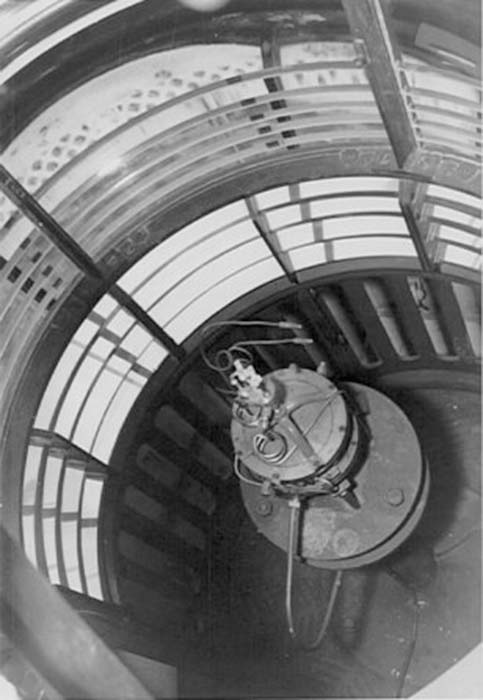
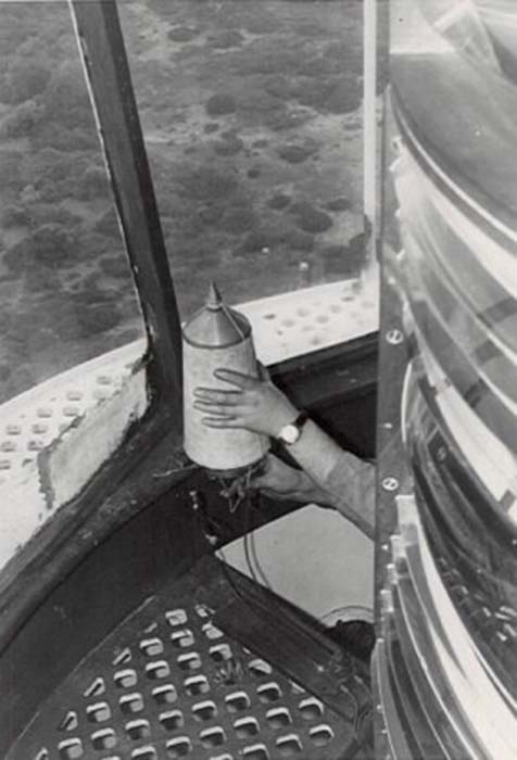
The light was made automatic in 1920, when the optic was replaced by an AGA. acetylene flasher and sunvalve.
continued below …
© All images are copyright of their respective photographers and are not to be used without permission.
| Title | Address | Description |
|---|---|---|
Althorpe Island (Lead) | Pondalowie Bay Rd, Inneston SA 5577, Australia | Go to Althorpe Island |
West Cape | Pondalowie Bay Rd, Inneston SA 5577, Australia | Go to West Cape |
Althorpe Island | Pondalowie Bay Rd, Inneston SA 5577, Australia | Go to Althorpe Island |
Wardang Island | Unnamed Road, South Australia 5573, Australia | Go to Wardang Island |
Cape Spencer | Cape Spencer Rd, Inneston SA 5577, Australia | Go to Cape Spencer |
Corny Point | 368 Lighthouse Rd, Corny Point SA 5575, Australia | Go to Corny Point |
Troubridge Hill | 90 Clan Ranald Rd, Honiton SA 5576, Australia | Go to Troubridge Hill |
Troubridge Shoal | 93 Sultana Point Rd, Sultana Point SA 5583, Australia | Go to Troubridge Shoal |
Port Adelaide | 2A McLaren Parade, Port Adelaide SA 5015, Australia | Go to Port Adelaide |
Port Adelaide (Heritage) | Unit 6/26-28 S Australia One Dr, North Haven SA 5018, Australia | Go to Port Adelaide |
Marino Rocks | Marino Rocks Lighthouse, 40 Bundarra Rd, Marino SA 5049, Australia | Marino Rocks |
Wonga Shoal | Wonga Shoal, South Australia, Australia | Go to Wonga Shoal |
Cape Jervis | Wonga Shoal, South Australia, Australia | Go to Cape Jervis |
continued from above …
240V mains power was connected in 1978 leading to a large increase in power. The new light was so powerful that it caused problems with reflection of white light over Web Rock again and the red screen had to be adjusted several times.
At the time there was a move to refurbish the light with a new lantern room but after much negotiation and intervention by the South Australian Branch of the National Trust the plans were modified to retain the existing structure.
The first keeper, Mr J. Dagweill, arrived in 1882 to find the apparatus was not in working order.
A telegram had to dispatched to the president of the Marine Board for assistance to bring the light into full working order.
The setting were still not perfect as the White light was reported to be shining over Web Rock, a major local shipping hazard. The keeper rectified this with a canvas screen covering the reef side.
The light was still reported to be seen over the rock and there was concern that the light being seen may be from one of the cottages. The canvas screen in the tower was extended as a precaution.
In the early days the lightstation was serviced twice a year by Government Steamer. Stores and mail were delivered weekly from Yorketown.
The tower experienced two earthquakes, the first in 1882 as referred to in the following telegram:
Friday, May 15th, 1882 – “This day commences with a fresh gale and violent squalls, attended by rain, wind being west. The middle and later parts of the day more moderate but still blowing with heavy squalls from wind veering from west to north-south-west. Headkeeper employed in various jobs about the station. Second keeper cleaning in lantern. At 2.53p.m. experienced severe shock of earthquake, which caused the lighthouse and cottages to shake violently. It lasted about three or four seconds and appeared to be travelling from west to east…
And, a second in 1902 as referred to in the following report from the headkeeper, Mr A. Webling.:…
Sept. 20th, 1902 – Fine, cloudy to gloomy … At 8:15 p.m., a severe earthshock was felt apparently travelling from our east to west, shaking the lighthouse considerably in fact, as I sat in the lantern on watch it appeared to me that the building would topple over. The vibration continued about 1 1/2 minutes at least. The apparatus was shaken to a great extent wrenching the bolts which hold it in position on top.
A trifling interference with the light which was corrected immediately after. A closer inspection of the buildings will be made during daylight.
Sept. 21st – “On inspection of buildings I found the tap of the apparatus torn from its fastenings and the iron casing which supports it broken at the floor. The base of tower about four feet from the ground cracked all round.
Sept. 22nd “The keepers secured the top of the apparatus and adjusted lamp and everything is satisfactory, so far as exhibition of the light. But I suggest for the satisfaction of those concerned and the safety of the tower that an inspection by a competent person he made without delay. The underground tanks are intact, so far as can be seen at present. The cottages suffered slightly, few cracks showing. Also the store has a few clacks. At 7.7 a.m. on 22nd a second shock was felt, but did no damage apparently although the cylinders rattled considerably and pendulum clocks stopped.
Some interesting entries from the keepers log:
20th June 1883: Found washed ashore near lighthouse a deal trunk containing one earthenware dish, two forks, one knife, one iron spoon and a pewter soup ladle. This evidently belonged to some small coastal vessel
27th August 1888: At 3.30 a.m. observed a most brilliant meteor to northward about 45 deg. above the horizon like a fiery globe falling to within about 25 deg. of the sea apparently exploding. Having a tail of light like a comet. The whole display lasting about 10 seconds and lighting up the whole district
A constant problem was moving sand due to the denuding of vegetation by the keepers’ goats and the neighbouring farmers stock.
As with many isolated lightstations, Corny Point saw its share of tragedy as can be seen from the following entries in the keepers log:
10th June 1885: Gardner’s child died at 2p.m. and he asked me to take him up to Warooka on Thursday.
11th June 1885: Started with Mr. & Mrs. Gardner and Miss Dagwell for Warooka at 8 and reached Warooka at 12 noon. Got coffin and grave dug and child buried by 4p.m.
16th May 1887: Mr. Gardner down to ask to take him to Warooka as child dead.
16th February 1895: Took Mrs. Parker and child to Warooka. Child died passing Dairy. Buried it at Warooka and home at 3.30a.m. on 17th.
In 1899, the assistant keeper drowned while swimming at the nearby beach with the body not being found for several days.
The light was transferred to the control of the new Commonwealth Government in 1917. The light was made automatic in 1920, the keepers were withdrawn and the cottages and store were demolished.
In 1925, the “Pioneer” reported that “Corny Point has been a popular seaside resort this season. At the lighthouse on New Year’s Day over 50 motor cars were parked.”
Technical Details
| First Exhibited | 1882 |
| Architect | |
| Status | Active |
| Location | Lat: 34° 53.8000' S Long: 137° 00.6350' E |
| Original Optic | |
| Current Optic | 500 mm focal radius |
| Automated | |
| Demanned | 1920 |
| Construction | White round stone tower and Chance 3rd order 8'11" dia lantern |
| Height | 15 m, 9 metres to base of lantern |
| Elevation | 30 m |
| Range | Nominal White: 16 nm Red: 13 nm Geographical: 16 nm |
| Character | Fl. W. (4) in 20 sec with Red sectors |
| Intensity | White: 24,027 cd Red: 5,045 cd |
| Light Source | 12V 100W C8 Halogen |
| Power Source | 12V |
| Operator | AMSA |
| Notes | As at Oct 2008 |
NB: Information is historical data and is not for navigational purposes.
Access
The light is on the uppermost point of the top of the Yorke Peninsula. There is a sealed road via Warooka and gravel from the Corny Point Township. The road from the south is gravel, but a very pleasant alternative route via Berry Bay.
The lighthouse reserve is open to the public.
Tours
No tours are available.
Keepers
We need your help in compiling a list of keepers for this lighthouse. If you have any information then send it to keeper@lighthouses.org.au.
Please include this lighthouse’s name, the keepers full name and what years they were keepers. Also include the same information for any other lights they were on.


