Hornby Lighthouse
The Hornby Lighthouse at South Head was built by public demand after the tragic shipwrecks of the Dunbar and the Catherine Adamson.
History
The wreck of the Dunbar & Catherine Adamson
Two shipwrecks led to public opinion in Sydney demanding that a lighthouse be erected so that the entrance to Jacksons Bay could be exactly defined.
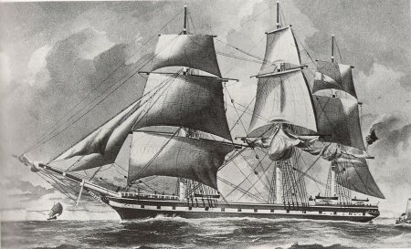
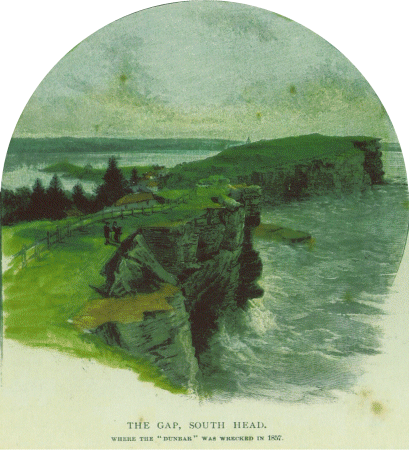
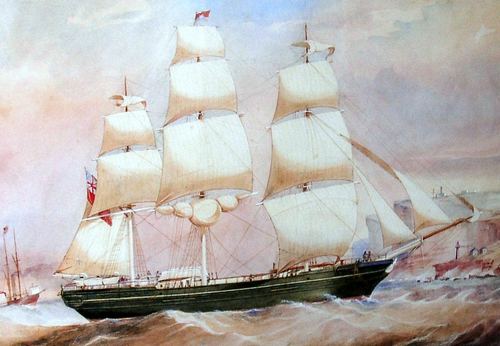
The first was the Dunbar of 1,334 tonnes in August 1857. It arrived at Sydney Heads on a gale ridden night. A pilot from the Watsons Bay Pilot station would have been unable to get out through the heads to guide the ship in, so the captain decided to seek shelter but got caught between The Gap and Outer South Head.
All attempts to claw the ship away from land failed and the ship crashed onto the rocks just after midnight.
It wasn’t till next morning when people at the signal station saw the wreckage that they realised the disaster had occurred.
There was only one survivor of the 122 on board. An Irish seaman, James Johnson, was found that morning clinging to a ledge. His family was to go on and play a significant role in the manning of New South Wales lighthouses.
Two months later in October 1857 another wreck occurred, this time off North Head. It was the Catherine Adamson, a clipper ship of 895 tonnes with the loss of twenty-one lives including the pilot who was guiding the ship in.
continued below …
| Title | Address | Description |
|---|---|---|
Eastern Channel | Green Point Walking Track, Watsons Bay NSW 2030, Australia | Eastern Channel |
Western Channel | Lady Bay Rd, Watsons Bay NSW 2030, Australia | Western Channel |
Hornby Lighthouse | S Head Heritage Trail, Watsons Bay NSW 2030, Australia | Hornby Lighthouse |
Macquarie Lighthouse | Old South Head Rd, Vaucluse NSW 2030, Australia | Macquarie Lighthouse |
Grotto Point | Lighthouse Track, Balgowlah Heights NSW 2093, Australia | Grotto Point |
The Building of the Hornby Lighthouse
The entrance to Jackson’s Bay, four-fifths of a nautical mile wide, seemly a good broad entrance, however as the two ships above had found, it was fraught with danger.
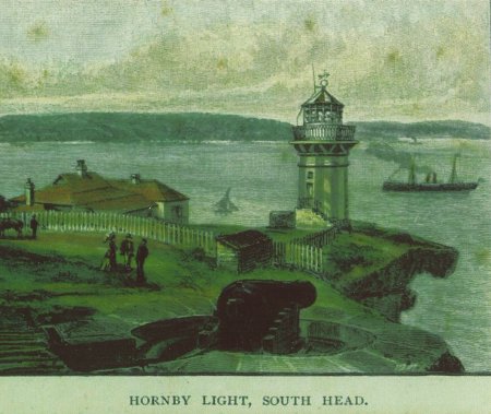
After these disasters a small lighthouse was erected at a low elevation on the extreme point of Inner South Head in 1858 amidst gun pits dug out by hard labour.
Seventy years after the arrival of the First Fleet it was the third lighthouse to be built, after Macquarie and Nobbys Head, within what is now the current boundaries of New South Wales. Others had been built at Cape Bruny (Tasmania) 1838, Swan Island (Tasmania) 1845, Goose Island (Tasmania) 1846 and Cape Otway (Victoria) 1848.
The light was opened by Sir William Denison, Governor of New South Wales, in 1858. It was named after the family of Governor Dennison’s wife, whose father became Admiral Sir Phipps Hornby, Commander in Chief of the British Pacific Fleet in the 1860s. However it was known as the Lower Light to distinguish it from the nearby Macquarie Light, New South Wales’ first.
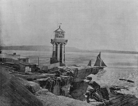
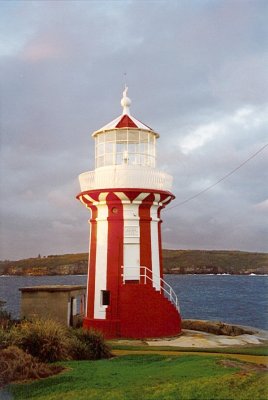
It was a circular tapered tower constructed with curved dressed sandstone with the light standing 9 metres above ground level. It was designed by colonial architect, Alexander Dawson.
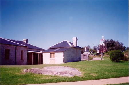
A simple Georgian style sandstone cottage, also designed by Dawson, was built to the west of the lighthouse. The sandstone was quarried from the local cliff faces. Extensions and repairs were carried out on the cottages in 1860 including a second cottage for the head keeper. A further addition a two roomed extension to each of the cottages was made in 1877. Each cottage had a small garden surrounded by a picket fence and an underground tank stored water for general use. The cottages were not connected to mains city water until 1897.
The original apparatus was a first order catoptric lens that had been purchased in 1853. The lamp was powered by kerosene which conformed with advances in lighthouse technology of the day. It was converted to incandescent gas in the early 1904, a huge advance in technology with benefits in safety, brilliance and cost. With the final conversion to electricity in 1933 it was automated and demanned.
The character was altered in 1948 to oscillating when a new Chance Brothers’ catadioptric lens was installed that had originally been in the lightship Bramble that had been anchored off the Sow and Pigs Shoal and had since been in use in the light tower at Shark Island.
The lighthouse tower has distinctive red and white vertical stripes.
Construction of the Second Battery in 1870 started the military use which saw the beginning of the dual use of the Headland. For a long while areas on the rugged Headland were exclusively Army and Navy territory and a permit was required for entry.
The Sydney Harbour Trust assumed responsibility for the Hornby Light in 1900 and undertook further renovations.
The light was not transferred to the Commonwealth in 1915 as it was considered only to be a harbour light.
For many years after automation in 1933, the little lighthouse sat neglected and the station and its cottages were later to become a victim of a dispute between the Commonwealth and the State government as to the future of the site. Finally with the onset of WW2, most of the Sydney shoreline fell under the control of the Army, and remained so for many years after, the cottages were occupied by serving married personnel. As the cottage were again in a very poor state, in fact had been in danger of being demolished, they were again renovated.
The National Trust had classified the site in 1975. The Army finally vacated in 1977, and the NSW Parks and Wildlife moved into the cottages as caretakers. Parks & Wildlife began a major program of restoration in 1977 with the reinstatement of the slate roofs and verandahs. The area is now part of the Sydney Harbour National Park administered by the Parks & Wildlife NSW and the little lighthouse and its cottages are painted and looks loved once again.
There are probably only a few remaining relics of the brig Two Friends, wrecked in 1851, sitting immediately below the lighthouse.
Unfortunately a concrete catwalk has sliced through Aboriginal rock carving discovered in the early days by children.
Keepers
Ironically the little cottage with its weather fence facing the Tasman Sea was to become the first home for keeper Henry Johnson — Believed to be the brother of the survivor of the Dunbar — and his young bride, Mary Anne.
Appropriately, the Johnson’s set up a dynasty of lighthouse keepers for years, where there was a lighthouse along the New South Wales Coast, there was sure to be a Johnson or a descendant.
We need your help in compiling a list of keepers for this lighthouse. If you have any information then send it to keeper@lighthouses.org.au.
Please include this lighthouse’s name, the keepers full name and what years they were keepers. Also include the same information for any other lights they were on.
Technical Details
| First Exhibited | 1858 |
| Permanent Tower | |
| Current Tower | |
| Status | Active |
| Location | Lat. 33°50'S. Long. 151°17'E. |
| Original Optic | |
| Current Optic | |
| Automated | 1933 |
| Demanned | 1933 |
| Construction | Sandstone |
| Height | 9m |
| Elevation | 27m |
| Range | |
| Character | |
| Intensity | |
| Light Source | 12 Volt 55 Watt Quartz Halogen Lamp |
| Power Source | |
| Operator | Sydney Ports Corporation |
| Custodian | Parks & Wildlife NSW |
| Notes |
Access
The headland is open all year via a walking track from the car park at Camp Cove. The tower is not open.
Tours
No
Accommodation
No
Museum
No
Associated Lighthouses
Sources
- Hornby Lighthouse – Roxford Bree
- Annette Flotwell for Photograph
- Denise Shultz for Photographs
- From Dusk Till Dawn for Photograph
- Greg Beck for Postcard
- Jeanne Eve for Colour Feature
- Sam Calder for Postcard
- Kristie Eggleston for Photograph
- From Dusk Till Dawn by Gordon Reid
- NPWS Lighthouses – Conservation Management and Cultural Tourism Plan
- Register of the National Estate
- Watsons Bay Sketchbook
- Woollahra Municipal Library


