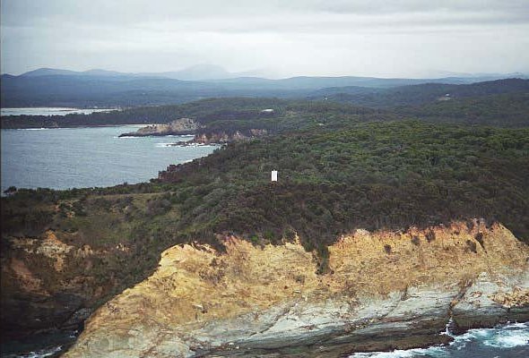
Burrewarra Point Lighthouse
The Burrewarra Lighthouse was first exhibited in 1974.
History
The Burrewarra Lighthouse was first exhibited in 1974 and was powered from batteries charged from the mains.
In 1984 it was converted to solar power, with battery backup.
Also at Burrewarra Point are the remains of concrete igloo buildings of No. 17 Radar Station used by the RAAF during World War II.
| Title | Address | Description |
|---|---|---|
Warden Head | Deering St, Ulladulla NSW 2539, Australia | Warden Head |
Burrewarra Point | Unnamed Road, Guerilla Bay NSW 2536, Australia | Burrewarra Point |
Montague Island | Unnamed Road, New South Wales, Australia | Montague Island |
Technical Details
| First Exhibited | 1974 |
| Permanent Tower | |
| Current Tower | |
| Status | Active |
| Location | Lat. 35°50' S , Long. 150°14' E |
| Original Optic | |
| Current Optic | |
| Automated | |
| Demanned | |
| Construction | |
| Height | 10m |
| Elevation | 62m |
| Range | 17 NM |
| Character | |
| Intensity | |
| Light Source | |
| Power Source | Solar with Battery Backup |
| Operator | NSW Transport Maritime Services |
| Custodian | NSW Department of Industry Crown Lands |
| Notes |
NB: Information is historical data and is not for navigational purposes.
Access
The lighthouse is a 700 metre walk from the end of Burri Point Road, Guerilla Bay. About 20 km south of Batemans Bay.
Site Access
The site is open but not the tower.
Tours
No
Accommodation
No
Museum
No


